eMOLT (Environmental Monitors on Lobster Traps)
The Gulf of Maine Lobster Foundation has supported the Environmental Monitoring on Lobster Traps (eMOLT) project since 2003. The eMOLT project is a not-for-profit collaboration of industry, science, and academics devoted to monitoring the physical environment of the Gulf of Maine and the Southern New England shelf. While the eMOLT program formed its origins at GOMLF it has expanded to include the work and initiatives of other NGOs, companies and governmental agencies throughout New England including The Lobster Institute, Ocean Data Network, NERACOOS, Center for Coastal Studies Provincetown, Lowell Instruments and more. Our current funding for the program comes from the Maine Sea Grant and MassTech under two initiatives.
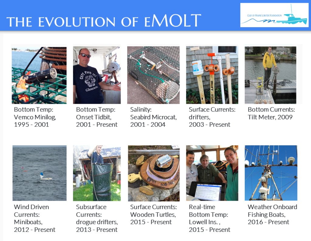
In a series of phases funded by the Northeast Consortium beginning in 2001, we developed low-cost strategies to measure bottom temperature, salinity, and current velocity of the water with the help of nearly 100 lobstermen dispersed along the entire New England coast.
The eMOLT Program now has over 200 vessels sending bottom temperatures in real-time, with more interested fishermen reaching out every day. Through the past few years we have worked with our partners to expand sensors to seining and trawling vessels in other parts of the fisheries. As the gear is hauled on deck, sensors automatically send data to a computer in the wheelhouse and plot it. The system also relays the position along with averaged temperature and depths via the satellite. Well over 8,200 hauls have been reported to date.
HOW IT WORKS
The system costs a few thousand dollars and is funded by various sources including MassTech, Maine Sea Grant and NOAA’s Northeast Cooperative Research Branch and the Integrated Ocean Observing System. The primary objective is to assimilate the bottom temperatures into numerical ocean models, much the same way the NWS (National Weather Service) uses observations of air temperatures on land in their forecast runs.
The current system consists of two main parts:
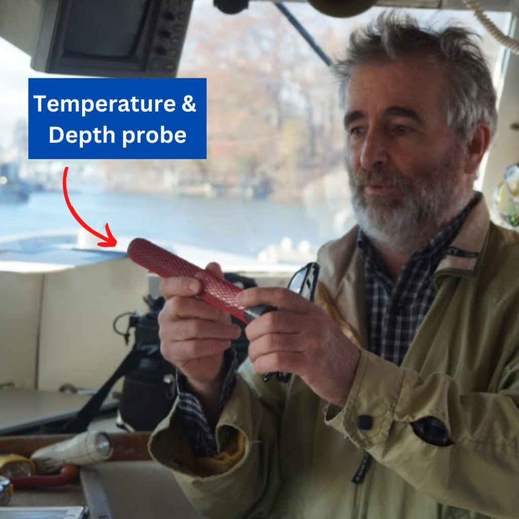
- The foot-long wireless temperature & depth probe is secured to the doors inside PVC pipe with stainless bolts. In fixed gear cases (lobster traps, longline, etc), the fisherman secures the probe however he sees fit. The probe collects data every minute for up to six months on one battery charge.
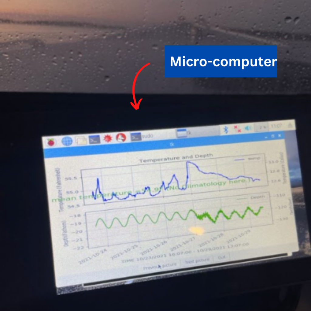
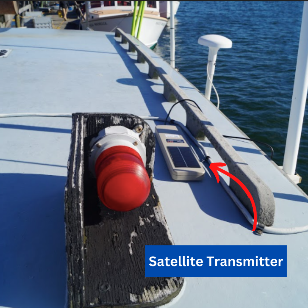
- The micro-computer with a 7” touchscreen is mounted in the wheelhouse. As the probe comes on deck, the computer automatically downloads the data via a Bluetooth connection and plots the results with a toggle button allowing fishermen to easily view previous hauls. It also calculates trawl statistics, compares observed values to historical records, and relays the statistics to a satellite transmitter. The micro-computer includes a satellite transmitter is mounted above the wheelhouse and sends statistics of each haul to an online map where positions are pinned to 10-mile-squares.
The system is designed to be totally automatic after it is installed. The installation usually takes less than an hour for two trained technicians with their own tools. All that is required is:
- 10 minutes of Captain’s time in determining:
- the best place to install system parts
- How to thread a wire topside
- Electric power for a micro-computer in the wheelhouse
- 10 minutes of Captain’s time to demo the system and bookmark websites in wheelhouse; and
- Hotspot/wifi password to send raw data
If you want to view real-time data, please click here.
For additional eMOLT information, click here to visit the eMOLT webpage.
If you are a year-round fisherman in relatively deep water and would like to participate, please fill out the form below.